
Aerial imaging is the process of capturing photographs or videos from an aircraft or drones to allow analysis of the ground below. With advancements in camera technology and availability of drones, aerial imaging has seen tremendous growth in recent years opening up new possibilities. This article explores how aerial imaging is being utilized across industries to gain insights and tackle challenges.
History and Evolution of Aerial Imaging
Aerial photography first began in the late 19th century for military reconnaissance purposes. However, it was only in the 1920s that aerial imaging grew commercially with surveys for mapping and agriculture. Through the 20th century, advancements in aircrafts and cameras allowed for higher resolution photos from the air. In recent decades, satellite imagery further expanded the scope of aerial data collection.
The biggest change came with drones which made aerial imaging much more affordable and accessible. Today’s drones are equipped with high megapixel cameras capable of capturing details from several hundred feet in the air. With drone technology advancing at a rapid pace, aerial imaging is finding widespread applications beyond its traditional uses in industries like infrastructure, agriculture, insurance and media.
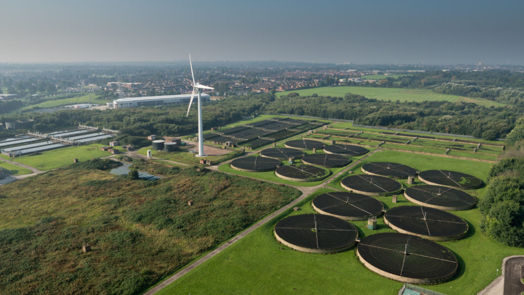
Infrastructure Monitoring and Management
Aerial Imaging provides an overhead view that allows detailed monitoring of large infrastructure projects like roads, bridges and construction sites. High resolution photos captured periodically can help spot defects, measure progress and ensure quality standards are met. For existing infrastructure as well, aerial surveys help with inspection, maintenance planning and damage assessment after natural disasters.
Many cities and transport departments now regularly use drones to monitor conditions of roads, bridges and rail lines from the air. The detailed visual data assists with budget planning and prioritization of repair works. During natural calamities, aerial imagery aids relief efforts by providing a macro view of affected areas and infrastructure bottle necks.
Agriculture Management and Analytics
For farmers, aerial imaging has emerged as a powerful tool for precision agriculture. Multispectral and thermal cameras on drones capture field conditions that are impossible to see with the naked eye. Imagery analysis helps detect moisture levels, nutrient deficiencies, disease infestation and crop yield variations within the same field.
Based on aerial data, digital farm maps are created delineating management zones. Variable rate application of inputs like water, fertilizers and pesticides is then implemented based on zone requirements reducing costs and wastage. Some farmers even use drone data to monitor livestock and automate irrigation. The software solutions available today make precision agriculture accessible for small holdings as well.
Real Estate and Insurance Assessment
Real estate and insurance industries rely heavily on aerial photos for assessment, mapping and underwriting. Detailed roof inspections, surrounding structure documentation and property verification are now regularly done using drones. Any changes in infrastructure, encroachments or property damages are easily captured from above avoiding costly on-site visits.
After natural disasters like floods, fires or earthquakes, drones enable rapid aerial surveys of affected areas for insurance claims processing and relief measures. Structural damages, debris clearance requirements and safety hazards are mapped. Insurance companies also use historical aerial imagery of properties for risk analysis and premium determination. Overall, aerial surveys help streamline operations and curb expenses for real estate and insurance sectors.
Media and Film Production
The creativity of drone filmmakers is revolutionizing the way landscapes and events are documented. Stunning aerial shots capturing weddings, sports, concerts and other occasions are becoming common thanks to stabilized cameras on drones. TV channels also use drones for excellent establishing shots during news and events coverage.
Productions houses rely on drones for aerial filming of locations scouting, tracking shots during shoots and establishing wide angles impossible with cranes or helicopters previously. The flexibility, safety and budget benefits of drones have made them an indispensable tool for media industry today. We are certain to see more innovative applications of aerial filming in movies, advertisements and virtual tours going forward.
Challenges and Regulatory Environment
While aerial imaging offers immense opportunities, safety considerations warrant prudent regulations. Issues around privacy, disruption to air traffic and sensitive area over-flights demand clear operating guidelines. Most countries now require drone pilots to obtain remote pilot license with rules around maximum altitude, proximity to people and critical infrastructure.
Technology challenges remain around extending flight range and duration of drones to support large area surveys. Image analytics also requires standardization for interoperability of data across solutions. As the industry matures, protocol will evolve balancing responsible usage with growth potential of aerial imaging applications. Overall, with safety addressed, aerial imaging promises to become an important part of our technological landscape in the coming decade.
Aerial imaging has seen immense advancements opening new vistas. Drones have democratized the process, making aerial data accessible across verticals. Computer vision solutions are allowing actionable insights from visual data. While regulations are catching up, aerial imaging is sure to transform various industries with its macro view from above. The future remains very promising as technologies merge for wide-scale automated analysis revolutionizing various domains.
*Note:
1. Source: Coherent Market Insights, Public sources, Desk research
2. We have leveraged AI tools to mine information and compile it